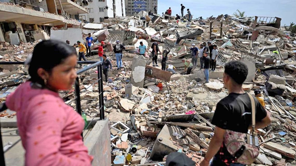

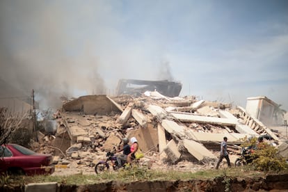
When two powerful earthquakes measuring 7.2 and 7.5 struck northern Venezuela on Wednesday, images of the devastation spread across news outlets within minutes: collapsed buildings, torn-off facades, damaged structures, and thousands of residents afraid to return to their homes for fear of further collapse. In cities such as La Guaira, the earthquakes left hundreds of buildings with significant structural damage and revived a longstanding question: why do some countries, such as Chile and Mexico, appear to withstand major earthquakes better than others?
One of the most recent examples dates back to September 16, 2015, when an 8.4-magnitude earthquake struck north-central Chile. Despite the strength of the quake, the number of destroyed homes was relatively small compared with other major seismic disasters around the world. Another example is the February 27, 2010, earthquake, when only one building — the Alto Río apartment tower in the city of Concepción, in the Biobío region — collapsed as a direct result of the seismic event.
Architects, engineers, and seismology experts point to several common factors behind Chile’s resilience: strict building codes, rigorous enforcement, and construction systems specifically designed to absorb seismic energy.
Rubén Boroschek, a professor in the Department of Civil Engineering at the University of Chile, cautions that any comparison between earthquakes must take into account important differences, including the type of earthquake and the proximity of populated areas to the epicenter. Even so, he argues that Chile’s main advantage has historical roots: the country’s early adoption, between 1906 and 1910, of construction systems specifically designed to withstand earthquakes.
According to Boroschek, the widespread use of structural walls has helped prevent building collapses and reduce damage to non-structural elements such as facades and interior partitions. “Our buildings are full of earthquake-resistant walls. You could cut through the wall at the base, and the building would most likely remain standing. If you do the same thing to beam-and-column buildings (frames), which are widely used in Venezuela, collapse is highly likely,” he says.
As Venezuelan authorities assess the extent of the destruction and inspect damaged infrastructure, Chile’s experience illustrates that an earthquake’s magnitude alone does not determine the level of devastation. Sergio Barrientos, director of the National Seismological Center (CSN) at the University of Chile, says other factors also play a role, including the distance between populated areas and the fault that generated the earthquake, as well as the characteristics of the ground on which buildings are constructed. The epicenter of Venezuela’s earthquakes was located between the cities of Yumare and Montalbán, in the states of Yaracuy and Carabobo, respectively, although La Guaira, on the coast, suffered the most severe damage.
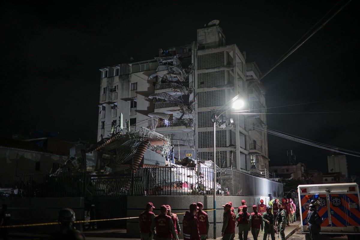
The Venezuelan government has declared La Guaira, located about 30 kilometers (19 miles) from Caracas, a disaster zone. Most of the apartment towers that collapsed during the earthquake were located there. The city had previously been devastated in 1999 by a catastrophic series of mudslides. In 2019, geographer Virginia Jiménez Díaz, of the Central University of Venezuela (UCV), who also holds a doctorate from the University of London, warned in an interview with the news outlet La Gran Aldea that the city remained as vulnerable as it had been two decades earlier: “Disasters are something we build every day.” She was referring to the construction of homes in ravines, on hillsides, and on unstable land. “This happens because institutions are weak. The creation of vulnerability has a great deal to do with the state’s inefficiency,” she said.
Paola Rodríguez, 24, was in Catia La Mar, in La Guaira, when buildings began collapsing within minutes. “I thought I was going to die. I ran, and I could barely keep my balance. But what shocked me the most was seeing the destruction that was left behind,” she said during a phone interview after several hours without communications.
Barrientos explains that the Venezuelan earthquake was very shallow, meaning the affected areas were located extremely close to the seismic source. “When the fault ruptures, it generates waves that weaken as they move farther away. It’s like the light from a candle: the farther away you are, the dimmer it appears,” he explains.
Marcelo Lagos, a professor at the Institute of Geography at the Pontifical Catholic University of Chile, adds that Chilean building standards are specifically designed to withstand very large earthquakes, typically above magnitude 8. “Those events generally occur off Chile’s coast. They are subduction earthquakes, where an oceanic plate dives beneath a continental plate. They tend to be extremely powerful, are often accompanied by tsunamis, and have one particular characteristic: they do not occur directly beneath human settlements, as happened in Venezuela,” he explains.
Lagos emphasizes that distance also plays a decisive role. “Seismic waves lose strength as they move away from the source. That is why construction standards in Chile are especially demanding in coastal areas,” he says.
The expert argues that Chile’s building code is the product of decades of accumulated experience. Every major earthquake has led to stricter engineering requirements and stronger oversight mechanisms. “That has allowed us to build a seismic governance system that gives us confidence that we can live with the threat of earthquakes. In Chile, earthquakes generally do not claim lives on the scale seen in other parts of the world. But that did not happen overnight,” he says.
Chile experienced the largest earthquake ever recorded, a magnitude 9.5 event that struck Valdivia in 1960, killing 1,655 people and leaving 2 million homeless. The country was also hit by the 8.8-magnitude earthquake in 2010 that devastated south-central Chile, although it was the tsunami that followed that claimed more than 500 lives and destroyed tens of thousands of homes.
Shallow earthquakes
In Lagos’ view, one of the most important factors for understanding what happened in Venezuela is the shallow depth of the earthquake. So-called crustal earthquakes, generated by active faults, are less common than the subduction earthquakes that characterize Chile.
“Venezuela has an important seismic history, but these events do not occur with the frequency we see in Chile. Shallow earthquakes require long periods to accumulate and release energy. That very rarity can become an enemy because it makes the risk less visible and creates a false sense of security,” he warns.
Barrientos believes one of the Venezuelan authorities’ most important tasks will be to study not only the buildings that collapsed but also those that remained standing. “Despite the destruction, many buildings remained standing. That indicates they were built in a way that allowed them to withstand both the amplitude and magnitude of the seismic movement, even though they were close to the fault. We need to learn from the buildings that survived,” he concludes.